Smart mobility links vehicles, infrastructure, and people using data and connectivity to make trips safer, cleaner, and more efficient. The benefits appear quickly in dense areas with continuous broadband, frequent transit, and concentrated demand.
In low-density places, however, those same technologies strain against long distances, patchy networks, and smaller budgets—so deployments stall or are never attempted.
This article is for transport planners, county and municipal leaders, fleet managers, grant writers, and systems integrators who must design or fund smart mobility in low-density settings. It identifies the technical, economic, policy, and social reasons rural communities are frequently left out and offers concrete, operational steps that work within real-world constraints.
Connectivity and sensing: the technical foundation and where it breaks
Smart mobility depends on two technical foundations: reliable communications and sufficiently detailed sensing or mapping data. When either is weak, systems lose effectiveness or fail to meet safety expectations.
Cellular and broadband coverage gaps
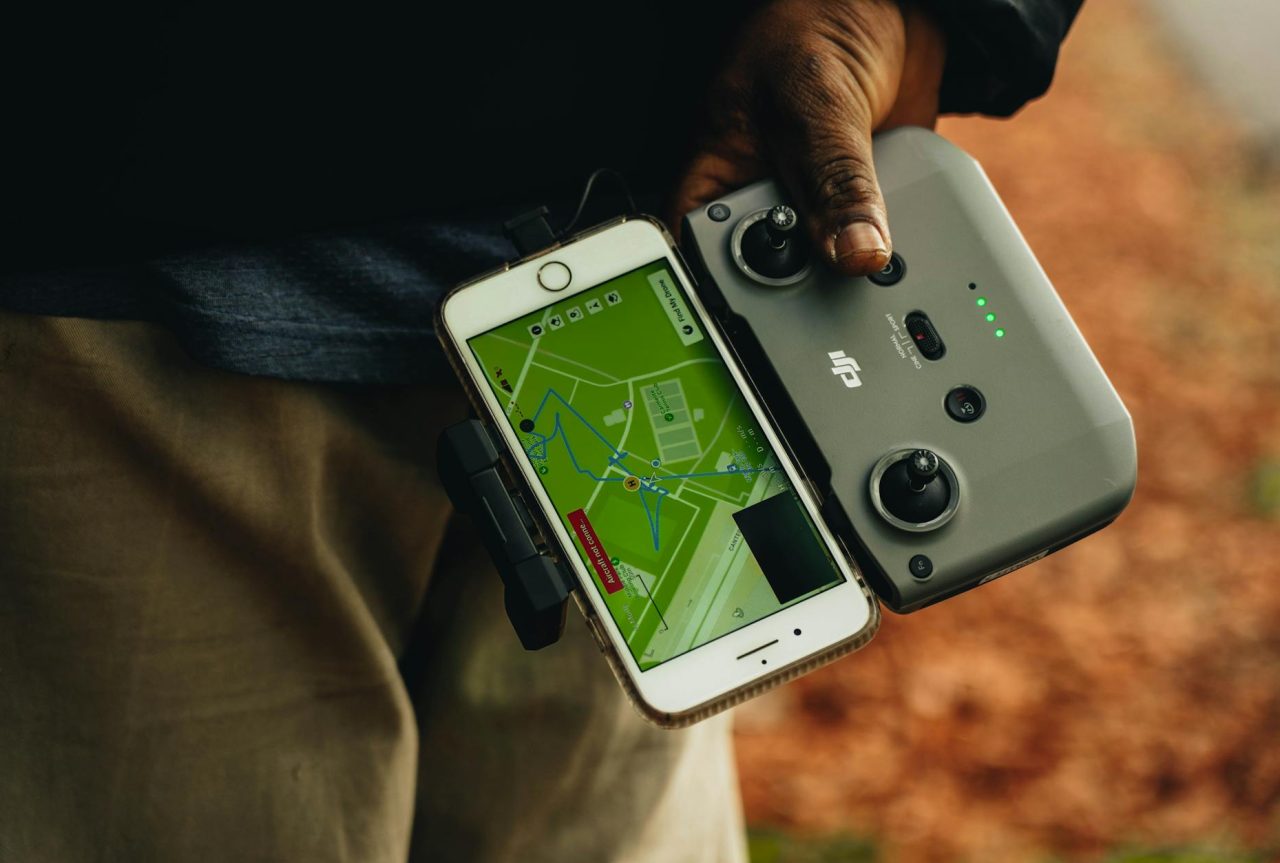
Most connected services require continuous or predictable data transfer: location pings, telemetry, OTA updates, and V2X (vehicle-to-everything) messages. Rural roads, valleys, and long stretches between settlements often have throughput under 10 Mbps and latency above 100 ms—levels that degrade real-time telemetry and safety messaging.
Practical consequences include missed V 2X alerts, delayed telematics for routing and battery monitoring, and unreliable remote diagnostics. Rolling out fiber or fixed wireless costs can run tens of thousands of dollars per mile in difficult terrain, and funding programs that weight grants by population tend to leave the most distant stretches unserved.
Sensing, mapping, and sparse data
Dense sensor networks—traffic cameras, smart streetlights, and crowdsourced vehicle data—enable lane-level mapping, incident detection, and predictive models. Rural roads often lack lane markings, have outdated mapping, and generate few crowdsourced events. That affects autonomous features, dynamic dispatching, and maintenance analytics.
Adding roadside cameras with communications and power typically costs $5,000-20,000 installed, plus recurring connectivity and maintenance. Solar LPWAN (low-power wide-area network) sensors reduce recurring costs but do not support video or high-resolution feeds.
Decision factor: choose the sensor fidelity required for the safety case rather than defaulting to camera-first deployments.
Economic realities-per-mile costs and weak market signals
Even with workable technology, the numbers often don’t add up for private providers or small operators.
High operating costs per mile
Low densities create long deadhead distances, higher vehicle hours per rider, and sparse demand that spikes subsidy needs. A shuttle covering 60 miles round trip to serve a handful of riders can produce operating costs that exceed $10 per vehicle-mile, pushing per-trip subsidies into unsustainable ranges unless funding is structured to reward coverage rather than pure ridership.
Procurement scale and product fit
OEMs and telematics vendors prioritize large, repeatable contracts. Rural operators often run small fleets with limited procurement clout and limited staff to manage complex systems.
The result: vendors avoid tailoring solutions for rural use, operators retrofit aging vehicles at extra cost, and rural feature sets—like extended-range batteries for long infrequent trips—stay underdeveloped.
Policy and institutional barriers that slow deployment
Funding silos and inconsistent permitting increase transaction costs for pilots and scale-ups.
Siloed funding and fragmented permitting
Broadband grants, highway money, and transit operating funds typically live in separate programs with different eligibility rules. A coordinated pilot often needs capital for sensors, grants for broadband backhaul, and operating subsidies—each from different pots.
Permitting for pole attachments, roadside V 2X radios, and right-of-way access varies across counties, raising legal and administrative costs.
Effective mitigation: create bundled funding calls that require joint applications from broadband, transit, and emergency management, or use memoranda of understanding that align budgets and performance metrics across agencies.
Social factors: adoption, accessibility, and trust
Technical solutions fail without community buy-in. Rural demographics often include higher proportions of older adults and residents with variable digital skills; that changes how services must be presented and operated.
Simple interfaces and hybrid customer journeys
Smart mobility can rely on apps, but phone reservations, printed schedules, and dispatcher-assisted booking often work better for older riders or households without smartphones. One common observation: confirming a booked ride by phone the day before reduces no-shows far more than push notifications alone.
Accessibility must be designed in from the start. Wheelchair users, people with mobility aids, and those with vision impairments require features that many early pilots omit—vehicle boarding compatibility, staff training, and accessible booking pathways are practical necessities.
Safety, maintenance, and rural operational constraints
Rural environments present unique maintenance cycles and hazards. Long response times, unpaved roads, seasonal weather, wildlife collisions, and valley GNSS problems change how safety systems perform and how fleets should be maintained.
Common failure points and diagnostics
- Poor GNSS in tree cover or narrow valleys—diagnose by collecting satellite counts and HDOP (horizontal dilution of precision); add local RTK or differential corrections when lane-level accuracy is required.
- Intermittent cellular drops—use dual: SIM routers with carrier failover and log handoffs for troubleshooting; run 30-day carrier-agnostic tests before committing to a single provider.
- Sensor fouling on roadside cameras—implement scheduled physical inspections and remote health checks; consider hydrophobic coatings and protective housings in dusty or insect-prone corridors.
Safety warning: When ADAS or autonomous features trigger repeated false positives tied to road surface or signage, consult a professional mechanic or systems integrator. Persistent telematics error rates above 5-10% usually indicate hardware calibration or integration issues requiring specialist attention.
Electrification specifics in cold or remote conditions
Cold weather reduces battery capacity and increases charging times. For rural fleets, centralized Level 2 charging at a depot is often more reliable than public fast chargers scattered across long routes.
Practical point: budget for a diesel or gasoline backup vehicle for the winter months until charging resilience improves. Ask mechanics about cold-weather charge acceptance and maintenance intervals for regenerative systems on gravel roads.
A realistic scenario: microtransit in a 400-square-mile county
Context: A county with 3,000 residents across 400 square miles piloted on-demand microtransit connecting hamlets to a grocery store three times a week. Coverage included patchy 4G, volunteer drivers, and one central garage with a Level 2 charger.
Choices that worked: a hybrid booking system (phone reservations handled by a dispatcher plus a lightweight app), tablets that cached route plans and uploaded logs when connectivity returned, and a central fixed wireless link funded by the broadband office to stabilize uploads. The county rented a diesel backup vehicle for the winter months.
Outcomes: initial per-trip costs were $30-40, then fell 20-30% after three months by consolidating trips and optimizing driver schedules. A common observation from staff: predictable 45- to 60-minute pickup windows reduced missed connections and dispatcher stress.
The pilot demonstrated that caching critical navigation data and keeping a human dispatch layer can substitute for continuous connectivity during early phases.
Design choices that improve reliability and lower cost
Build systems that tolerate intermittent networks: local caching with intermittent sync prevents mid-trip failures and reduces wasted data costs.
- Match sensor fidelity to the use case: use LPWAN for long-life environmental sensing and reserve higher-bandwidth gateways for occasional video or rich datasets.
- Procure for modular retrofits: favor telematics modules that bolt into existing vehicles to lower capital barriers for small operators.
- Use hybrid user interfaces: phone booking, paper schedules, and targeted apps increase adoption across demographic groups.
- Create performance metrics that reward coverage and reliability rather than raw ridership numbers to change vendor incentives.
Funding models and contracting approaches that scale
Blended finance and phased contracting reduce provider risk and improve outcomes. Structure grants so broadband, transportation, and emergency services co-fund shared infrastructure—an existing model highlighted in transportation research centers and European smart mobility frameworks.
Contract terms should include an initial 6-12 month pilot with explicit reliability gates and user-satisfaction thresholds before scale-up.
When to bring in outside experts and what to ask?
Engage a systems integrator or rural mobility consultant when projects span telecom deployment, vehicle retrofits, and roadside installations. Request a technical readiness report with a connectivity heatmap, sensor needs tied to specific safety scenarios, and a staged cost model that shows capital and recurring costs for 12-36 months.
For electrification, ask mechanics about cold-weather degradation rates, expected warm-up charge times, and maintenance intervals for regenerative braking on gravel roads. For connectivity, request a 30-day, carrier-agnostic connectivity test that logs drop frequency and throughput during peak and off-peak periods.
Small operational practices that improve day-to-day reliability
Confirm rides by phone the day before to reduce no-shows.
- Use predictable pickup windows (45- 60 minutes) rather than overly dynamic timetables when connectivity is unreliable.
- Train local staff for basic diagnostics—SIM swaps: cable checks, device reboots—to avoid vendor field visits that cost time and money.
- Budget for seasonal maintenance: protective housings, salts and grit management, and battery conditioning in winter months.
One short anecdote-style observation often reported in county pilots: drivers learn local “work-arounds”—like switching to paper directions where GPS jumps are common—and those low-tech fixes matter as much as any software patch.
Policy changes that would make the biggest difference
Structure grants to measure geographic coverage and cost-per: mile alongside ridership, so funding incentivizes service area equity.
- Create standardized, low-friction permitting across counties for roadside connectivity to reduce transaction costs for V 2X radios and pole attachments.
- Require bundled funding applications that pair broadband and transportation projects so infrastructure supports multiple uses.
Research centers and program frameworks that focus on multimodal integration and public-private collaboration provide concrete examples for these policies; see Mobility Systems research and the European Commission’s smart mobility overview for program-level approaches and pilot designs.
Safety warnings and required tools
Safety warning: do not operate ADAS or autonomous functions beyond manufacturer limits on roads with missing lane markings or degraded GNSS. Require operator override capability and human monitoring during all pilot runs involving automation.
Tools and checks to include before launch: dual-SIM 4G/5G routers with failover, tablet or onboard units with local caching, simple diagnostic logs for connectivity and GNSS metrics, spare SIMs, basic mechanical toolkits for on-route fixes, and an incident reporting form that ties vehicle events to connectivity logs.
Final practical takeaways
Rural exclusion from smart mobility is systemic: connectivity gaps, high per-mile costs, fragmented funding and permitting, and social barriers interact to keep many low-density communities off implementation roadmaps. Addressing only one element yields limited results.
Actionable priorities are clear: design for intermittent networks, pair digital services with phone and paper options, procure for retrofits and modular upgrades, align funding across broadband and transport programs, and set performance metrics that reward coverage and reliability.
When technical issues exceed local capacity—persistent GNSS errors, recurring telematics failures above 5-10%, or complex pole-attachment permitting—bring in a specialist and ask for a readiness report that maps costs and risks for 12-36 months.